Lugo Verde

Mera Mills Route
A magical place with waterfalls, historic mills and rich biodiversity. Ideal for hiking, it offers breathtaking views and rock formations.
On this route, we’ll travel through a magical, almost untamed landscape, which seems almost impossible to find so close to a town of nearly 100,000 inhabitants.
The River Mera, a tributary of the Miño, carves out a very distinctive valley that runs through much of the municipality’s territory. It is also here that the Camino Primitivo runs – the first route to Santiago, a great civilising route along which people and ideas from almost all of Europe travelled.
In the final stretch of its course, the Mera forms a beautiful waterfall which, together with its mill, marks the end point and true highlight of this route. The river’s right bank borders a communal mountain, the main reason why it has been preserved in its current state. The inhabitants of the parish of Orbazai love and respect this mountain. Thanks to them and their ancestors, we can enjoy this wonderful walk today, and we must show our gratitude by treating the land and the river with the utmost care and absolute respect.
We call this route the ‘River of Mills’, not because other rivers lack them, but because, until very recently, the mills on the River Mera were of great importance to the city of Lugo, helping to supply it with flour. Along the stretch we are about to walk, we will come across three magnificent examples, complete with their millstones and reservoirs; although they are no longer in operation, their hydraulic systems remain in good condition.
Flora and fauna
Agricultural changes have brought an end to the traditional use of the mountains, and in recent decades the vegetation has recovered exuberantly, forming a natural forest.
Oaks, alders, ash trees, willows, birches, hazel trees, wild cherry and pear trees, bloodroot, reeds, elderberries, blackthorns, holly… The smaller flora is countless, and the abundance of the beautiful royal fern is particularly striking, especially on the final stretch of the path, where the river narrows and its flow increases. As we go along, we will also see a wide variety of mushrooms, including many amanitas… the most poisonous of them all.
As for the fauna, there is a great wealth of birdlife; with a bit of luck, we may even spot a blackbird or a river warbler, which are generally difficult to observe. The fish population is limited to trout and a few eels that have managed to survive the high hydroelectric dams; however, they are not easy to spot, as they tend to hide in the mud at the bottom. Before the reservoirs were built, they were very abundant, and fish farms were set up to catch them; we shall see an example of one. Among the amphibians, you can spot the common toad and the moor frog, which will leap into the water as we walk along the bank.
Itinerary
We follow the signpost and arrive at a spring. We turn slightly to the right, and then again, and follow the river downstream to see a mill with its waterwheel.
We retrace our steps, now heading steadily upstream. The stream we have just seen has a significant influence on the appearance of the river, which for a good stretch seems deep and flows very slowly. Little by little, it regains its natural appearance, and we see that it is in fact a river with a fairly swift current, flowing over a bed of sand and granite stones.
We come across the remains of a fish farm. In the past, eels were very abundant, and during migration seasons they were caught by the quintal in the Miño and its tributaries.
Shortly afterwards, we come across a narrow path and a bridge. This spot is a ‘puerto’. On rivers, this term refers to a ford or natural crossing through a shallow stretch, artificially extended on both banks by a path that cuts across them, starting at riverbed level and rising gently. People, livestock and carts could cross it when the current allowed, which was precisely in late spring, summer and autumn – that is, during the farming seasons.
We continue along the same riverbank and soon come across another mill. This one does not require a weir on the River Mera, as the water reaches it via a ‘raiiro’ – an artificial channel that collects water from the river upstream, making use of the gradient.
From here, we come across an abundance of royal ferns.
Shortly after the mill, we move slightly away from the river, though always running parallel to its course. We reach a waterfall formed by large cliffs and, on the opposite bank, we can see the Abelleira mill, currently used by a private owner as a second home. A place of breathtaking beauty.
Here we may or may not take a shortcut upstream – a rather difficult and dangerous, oval-shaped path – which would take us back to the same spot.
We return downstream, now along the riverbank; here we’ll find some astonishing sculptures carved into large rocks. Hikers can let their imagination run wild and try to guess what they are; we do not know for certain. We will simply say that two of them are of Romanesque style: the head of an Agnus Dei, like those adorning the spires of many medieval churches, and a monstrous creature peering out.
Now the river has an island in the middle, over a hundred metres long, formed by large rocks and covered in lush vegetation. We reach the same path we came along and follow it to the bridge. Then, we turn right and, continuing in the same general direction, follow a path at a considerable height which offers us a different view of the riverbank and also of the land on the other side of the Mera. A little further on, we naturally return to the river for another stretch. A new signpost marks the point where we veer off the path we came along for just over a hundred metres; we rejoin it very close to the Segade spring and the picnic area.
Acequia del Rey Chiquito
A medieval canal of natural beauty and cultural significance, ideal for strolling and enjoying the countryside, and a testament to historical hydraulic engin...
O Veral Nature Centre
An educational space set in a natural environment, featuring nature trails and interactive workshops, ideal for exploring flora and fauna and promoting envir...
That Caneiro by Olga
A natural spot with lush vegetation and walking trails, ideal for leisure activities and moments of contemplation by the river.

Light Factory
A cultural space converted from an industrial site, it hosts exhibitions, workshops and events, blending historical heritage with contemporary art.
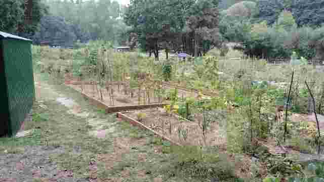
Río Rato Urban Allotments
A community space by the river that promotes sustainable agriculture, environmental education and social cohesion through workshops and activities for all ages.

Quarry site
A rural route in Lugo featuring natural landscapes, historic bridges and viaducts, churches and lush forests. Ideal for walking and enjoying nature.

Mera Mills Route
A magical place with waterfalls, historic mills and rich biodiversity. Ideal for hiking, it offers breathtaking views and rock formations.

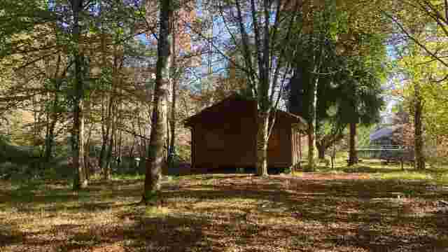
Route of the Huts
A nature and ethnographic trail featuring lush vegetation, diverse wildlife and cultural features such as mills and bridges, ideal for nature lovers.

The old agricultural town of Lugo
A magical route featuring a unique Roman monument, traditional agricultural landscapes, Galician stone walls and a rich variety of flora, ideal for cultural ...

Little Froilan
A sightseeing route in Lugo that combines history and nature: the Roman Wall, the Cathedral, the Regueiro das Hortas, the Roman Bridge and the San Lázaro For...

from Lucus
A historic route featuring Roman walls, ancient bridges, lush natural surroundings and an iconic cemetery of artistic and historical significance. Ideal for ...

Lamas
A nature trail featuring beautiful scenery, woodlands and street art. Ideal for getting away from the hustle and bustle and enjoying nature near the River Miño.

Scribbles
This urban route offers panoramic views, street art and natural scenery, with the ruins of a Roman aqueduct being a particular highlight. Ideal for cultural ...

The High Banks – Up the Miño
An ideal route for water sports, with scenery featuring oak groves and meadows. Rowing and catamaran trips are particular highlights. The waters are teeming ...

Green Belt
A 20 km circular route in Lugo, notable for its woodlands, street art and rich wildlife. Ideal for walking and enjoying nature without leaving the urban area.

The Fervedoira Trail
A route through Lugo featuring spectacular scenery, street art, lush vegetation and picturesque neighbourhoods. Ideal for lovers of nature and culture.

The West Bank
Lush forests, enchanting footpaths and ethnographic heritage offer a unique experience for walkers, with breathtaking views and a rich local history.