Lugo Verde

The old agricultural town of Lugo
A magical route featuring a unique Roman monument, traditional agricultural landscapes, Galician stone walls and a rich variety of flora, ideal for cultural ...
THE ANCIENT AGRICULTURAL REGION OF LUGO
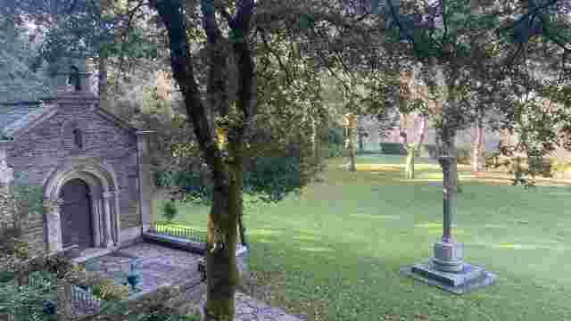
This circular route begins and ends in the village of Santa Eulalia, or Santalla de Bóveda, one of the most beautiful villages in the central region of Lugo, boasting excellent traditional architecture and the distinction of being home to a monument that is unique in the world.
The Roman sanctuary at Bóveda
Discovered in 1926 and declared a National Artistic Monument in 1931, it is now listed as a Site of Cultural Interest. It is a small Roman structure, possibly dating from the 4th century, the exact purpose of which is unknown. It may have been linked to the worship of water, and in later centuries it was used as a Christian church. It has even been linked to the Galician heresiarch Priscillian, the first internal martyr of Christianity. Rivers of ink have been spilled over this small site, which still retains an air of mystery. Amongst other treasures, it preserves Roman wall paintings of extraordinary perfection and great taxonomic realism, in dazzling colours.
Santalla de Boveda is one of the most magical places in Galicia. A visit to this unique monument, unrivalled in Europe, is enough to make a stay in these parts unforgettable.
Agricultural landscape and flora
The route winds through a vibrant agricultural landscape, yet one largely untouched by the vicissitudes of recent decades. The footpaths, ravines, watercourses and trails are in excellent condition, and their verges continue to offer walkers their traditional character. Furthermore, agriculture and livestock farming remain active, and the landscape retains its distinctly human character, although, of course, green meadows now predominate over arable land, rather than the classic main crops of wheat and potatoes, with turnips and winter thyme alternating between them.
One of the main attractions is the walls or fences marking the boundaries of the farms, which display at least three of the classic types of Galician stone fences: stone walls, eroded rubble walls and mixed walls.
The plant life is impressive. Oak groves and mixed woodlands, or ‘fragas’, abound, with an almost equal presence of the two oak species most characteristic of Galicia (Quercus robur and Quercus pirenaica). In addition, there are alders, birches, chestnut trees, walnut trees and the two native species of ash, various willows, elderberries, bloodroot, lime trees, holly, the three main species of gorse (arnal, femia and gateño), broom, queirogas and white uces. On our route, we will cross the beautiful River Mera and its small tributary, the Mendo stream, surrounded by trees that support aquatic life, amongst which the alder predominates, although there are also some poplars. We shall also come across some fine examples of human craftsmanship: for example, excellent traditional mills, now disused but well preserved along with their dams and hydraulic structures.
Itinerary
At the main square or street, where the Roman monument stands, we turn towards the village of Cabanas, following the signposts along a narrow cobbled path.
We can already make out the three types of earthen enclosures. On the left, a meadow with native trees and a solitary, sturdy eucalyptus; on the right, a pine forest.
The path joins another next to a brick house, in the village of Cabanas (also in the parish of Bóveda). We turn left and enter the village. On the right is a stable. On the left is a fine country house with an enclosed eaves: a barn, a hayloft, an oak tree and a doorway clad in stone slabs, just like the hayloft.
After the fountain, we turn left onto a path that remains tarmac-surfaced. We’ll see wooden gates and fruit trees along the way, until we reach the River Mera. Next to it, we come across a fine mill with its water wheel.
We continue along the path and cross the bridge. The tarmac ends and we pass through low-lying land, with gorse bushes that were once so important to the agricultural economy as manure for the stables and fuel for the bread ovens. To the left, we can see the course of the river, marked by the trees on its banks.
After about 250 m, we reach another dirt track and turn right to climb up to San Miguel de Bacurín. As we climb, the river lies to the right and the meadow to the left, followed by the woodlands of the San Miguel manor house, with conifers, eucalyptus and fir trees, as well as native species. As we climb, we take in a beautiful view to the right: Cabanas and, in the distance, the bell tower and the stone slabs of Santalla de Bóveda. We continue along the dirt track until it ends at a tarmac road, which we follow straight on, first towards the pazo, with its beautiful gateway, and then towards the lovely Romanesque church. We continue along the path that runs alongside the manor’s grounds. For a short stretch, we follow the route of the Camino Primitivo, but we head towards Lugo, not towards Santiago.
A little further on, a beautiful fir plantation begins. We take an old path to the left – the ‘church path’ – which leads us, through holm oaks, meadows and conifers, to the main road and the entrance to the village of Portafontao. We pass through the village, which belongs to the parish of Bacurín, amongst farmland, holm oaks – some cultivated, others felled for firewood – with their characteristic branch-covered crowns.
Finally, after a downpour, we take another unpaved track to the left. The agricultural landscape continues.
Then, on the left, fine pine trees, and on the right, a small hill with large stone slabs.
We reach the road and continue to the left towards Santalla. We cross the River Mera and can see the two mills up close on the right, with their water-powered systems. The ‘quella’ at the top of the meadow is striking; it is an irrigation system very common in the Caurel and Ancares mountain ranges, but quite rare in the central region of Lugo.
We return to the road and, at the fork, take the path on the left. On the right, we’ll see a beautiful cultivated oak grove, with a large haystack; and soon we’ll be back in Santalla de Boveda, the hub, focal point and landmark of our walk through the farmland of Lugo.
Acequia del Rey Chiquito
A medieval canal of natural beauty and cultural significance, ideal for strolling and enjoying the countryside, and a testament to historical hydraulic engin...
O Veral Nature Centre
An educational space set in a natural environment, featuring nature trails and interactive workshops, ideal for exploring flora and fauna and promoting envir...
That Caneiro by Olga
A natural spot with lush vegetation and walking trails, ideal for leisure activities and moments of contemplation by the river.

Light Factory
A cultural space converted from an industrial site, it hosts exhibitions, workshops and events, blending historical heritage with contemporary art.
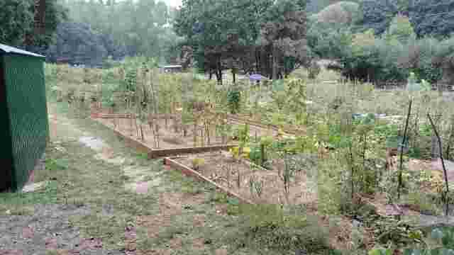
Río Rato Urban Allotments
A community space by the river that promotes sustainable agriculture, environmental education and social cohesion through workshops and activities for all ages.

Quarry site
A rural route in Lugo featuring natural landscapes, historic bridges and viaducts, churches and lush forests. Ideal for walking and enjoying nature.

Mera Mills Route
A magical place with waterfalls, historic mills and rich biodiversity. Ideal for hiking, it offers breathtaking views and rock formations.

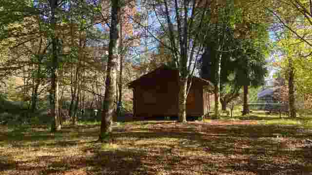
Route of the Huts
A nature and ethnographic trail featuring lush vegetation, diverse wildlife and cultural features such as mills and bridges, ideal for nature lovers.

The old agricultural town of Lugo
A magical route featuring a unique Roman monument, traditional agricultural landscapes, Galician stone walls and a rich variety of flora, ideal for cultural ...

Little Froilan
A sightseeing route in Lugo that combines history and nature: the Roman Wall, the Cathedral, the Regueiro das Hortas, the Roman Bridge and the San Lázaro For...

from Lucus
A historic route featuring Roman walls, ancient bridges, lush natural surroundings and an iconic cemetery of artistic and historical significance. Ideal for ...

Lamas
A nature trail featuring beautiful scenery, woodlands and street art. Ideal for getting away from the hustle and bustle and enjoying nature near the River Miño.

Scribbles
This urban route offers panoramic views, street art and natural scenery, with the ruins of a Roman aqueduct being a particular highlight. Ideal for cultural ...

The High Banks – Up the Miño
An ideal route for water sports, with scenery featuring oak groves and meadows. Rowing and catamaran trips are particular highlights. The waters are teeming ...

Green Belt
A 20 km circular route in Lugo, notable for its woodlands, street art and rich wildlife. Ideal for walking and enjoying nature without leaving the urban area.

The Fervedoira Trail
A route through Lugo featuring spectacular scenery, street art, lush vegetation and picturesque neighbourhoods. Ideal for lovers of nature and culture.

The West Bank
Lush forests, enchanting footpaths and ethnographic heritage offer a unique experience for walkers, with breathtaking views and a rich local history.