Lugo Verde

Quarry site
A rural route in Lugo featuring natural landscapes, historic bridges and viaducts, churches and lush forests. Ideal for walking and enjoying nature.
This route, which is predominantly rural, will take us not only through the magnificent natural landscape of Lugo, but also through the lands from which many of the stones are said to have come – stones that have been crowning our great city for 1,700 years: the Land of Canteiras.
ROUTE
We’ll begin our route at the Porta da Estación, one of the five most modern gates in the city walls, built to connect the city with the railway lines upon their arrival in Lugo in the late 19th century.
We’ll head down towards the River Rato along Calle Nicomedes Pastor Díaz, then along Montero Ríos, and finally along the Camiño de Friás. This place name recalls the Frías ravine, the name once given to the whole area now known as the Estación neighbourhood.
We’ll continue along the Rato towards the historic neighbourhood of A Chanca, before reaching the point where the river joins the Fervedoira, a beautiful river that rises almost 11 kilometres upstream from where we are now.
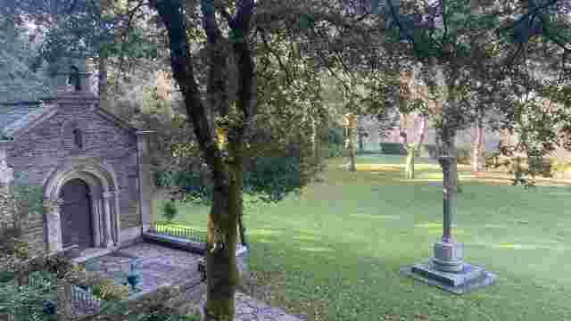
Once we reach Chanca, we’ll enjoy a magnificent historic setting, with the Old Bridge of Chanca and the Chanca Viaduct (1871–1874) taking centre stage. At this point, we’ll join the Primitive Way of St James and walk a short stretch in the opposite direction to the pilgrims heading for Compostela.
As we head up the Chanca, we’ll first come across the Church of St James the Apostle in Castelo; we’ll cross through the neighbourhood and, for a stretch of the route, walk very close to the railway tracks. This is one of the few areas of the city where you can enjoy this privilege.
Once we leave the railway tracks behind, we’ll enter the lush landscape of El Rato: oak groves, copses and centuries-old forests that will make us feel a world away from the city.
In this area, there are countless options for continuing our walk. We suggest taking the Penoucos road to Bosende and then heading down to Rato, but it’s also possible to wander off and enjoy a beautiful stroll through this famous ‘Land of Quarries’, for example, as far as Buratai or Barbaín.
Our return to the historic centre will be via the pleasant Rato promenade, with the option of walking along the riverbank or taking the alternative path situated a little further up on the eastern bank.
PLACES OF INTEREST
Railway station: The railway reached Lugo in 1875 with the opening of the A Coruña–Lugo line, and since then the city has expanded eastwards. Lugo station is a two-storey building with an elongated rectangular floor plan.
Camino de Friás: Barranco de Friás was the name given to the Estación neighbourhood before the arrival of the railway. The memory of that old place name lives on today in this footpath, which connects Rúa do Portiño with Montero Ríos.
River Fervedoira: one of the city’s longest rivers, which flows entirely within the municipal boundaries. The Fervedoira rises in As Carreciñas, at an altitude of 578 metres, on the Outeiro de Fompedriña, near the village of Vilachá, in the parish of Labio. After passing through the parishes of Rubiás, Pedreda and Santa María de Muxa, it enters the city via the O Portiño neighbourhood and flows into the River Rato, with which it joins to form the River Miño.
Acequia del Rey Chiquito
A medieval canal of natural beauty and cultural significance, ideal for strolling and enjoying the countryside, and a testament to historical hydraulic engin...
O Veral Nature Centre
An educational space set in a natural environment, featuring nature trails and interactive workshops, ideal for exploring flora and fauna and promoting envir...
That Caneiro by Olga
A natural spot with lush vegetation and walking trails, ideal for leisure activities and moments of contemplation by the river.

Light Factory
A cultural space converted from an industrial site, it hosts exhibitions, workshops and events, blending historical heritage with contemporary art.
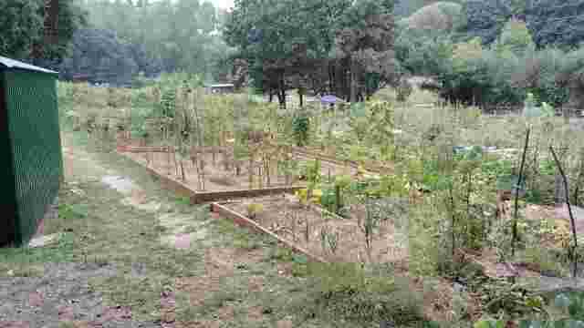
Río Rato Urban Allotments
A community space by the river that promotes sustainable agriculture, environmental education and social cohesion through workshops and activities for all ages.

Quarry site
A rural route in Lugo featuring natural landscapes, historic bridges and viaducts, churches and lush forests. Ideal for walking and enjoying nature.

Mera Mills Route
A magical place with waterfalls, historic mills and rich biodiversity. Ideal for hiking, it offers breathtaking views and rock formations.

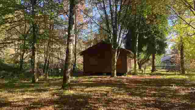
Route of the Huts
A nature and ethnographic trail featuring lush vegetation, diverse wildlife and cultural features such as mills and bridges, ideal for nature lovers.

The old agricultural town of Lugo
A magical route featuring a unique Roman monument, traditional agricultural landscapes, Galician stone walls and a rich variety of flora, ideal for cultural ...

Little Froilan
A sightseeing route in Lugo that combines history and nature: the Roman Wall, the Cathedral, the Regueiro das Hortas, the Roman Bridge and the San Lázaro For...

from Lucus
A historic route featuring Roman walls, ancient bridges, lush natural surroundings and an iconic cemetery of artistic and historical significance. Ideal for ...

Lamas
A nature trail featuring beautiful scenery, woodlands and street art. Ideal for getting away from the hustle and bustle and enjoying nature near the River Miño.

Scribbles
This urban route offers panoramic views, street art and natural scenery, with the ruins of a Roman aqueduct being a particular highlight. Ideal for cultural ...

The High Banks – Up the Miño
An ideal route for water sports, with scenery featuring oak groves and meadows. Rowing and catamaran trips are particular highlights. The waters are teeming ...

Green Belt
A 20 km circular route in Lugo, notable for its woodlands, street art and rich wildlife. Ideal for walking and enjoying nature without leaving the urban area.

The Fervedoira Trail
A route through Lugo featuring spectacular scenery, street art, lush vegetation and picturesque neighbourhoods. Ideal for lovers of nature and culture.

The West Bank
Lush forests, enchanting footpaths and ethnographic heritage offer a unique experience for walkers, with breathtaking views and a rich local history.